Groundwater Flow Modeling
| PROJECT NAME & LOCATION | DATE STARTED | DATE COMPLETED | |||||
| Western Santa Fe River Groundwater Protection Model |
September, 2005 | September, 2010 |
| ACTIVITY TITLE | APPROXIMATE CONTRACT VALUE | |||
| Groundwater Flow Modeling | $380,000 |
| CLIENT NAME & ADDRESS | TECHNICAL CONTACT | |||
| Coca-Cola North America One Coca-Cola Plaza NW Atlanta, GA 30313 |
Jon Radtke P.G. (404) 676-9112 [email protected] |
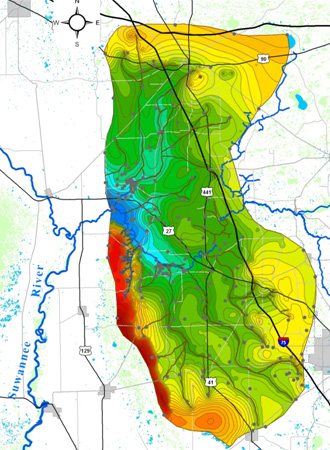
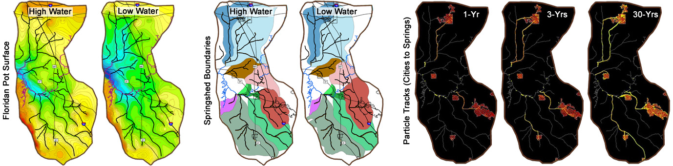
Model simulated low-water groundwater levels and location and pattern of simulated karst conduits (gray lines) relative to the river and wells used for calibration
The 3D model included five layers representing a discontinuous surficial aquifer, a discontinuous clay confining unit, and three layers within a limestone aquifer delineating river interaction and conduit development zones. The model was calibrated to two separate datasets describing groundwater levels and spring discharges under high-water and low-water conditions using the same permeability framework but different recharge configurations. More than 1000 model runs were performed with variations in matrix conductivity and conduit pattern and dimensions. The final model matched observed conditions at more than 175 monitoring wells and 13 springs in the WSFRB.
A full description of the model development is available at: www.geohydros.com/CCNA/.
Final results revealed sets of dendritic conduit systems that deliver water to the largest springs from as far as 40 km across the basin. Simulated groundwater velocities range from 10-4 m/day in the matrix to 10+3 m/day in the conduits. Simulated travel-times reveal that spring vulnerability is determined by proximity to conduits. The broader significance is that plausible karstic groundwater flow conditions can be reasonably simulated if key karst features, such as springs, swallets, caves, and traced flow paths, are included in the model framework. Predictions derived from models constructed in this manner will be more representative of actual conditions in the aquifer than those derived from models based on traditional porous-media assumptions and techniques.
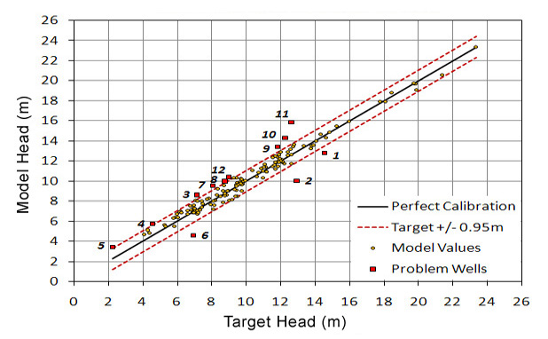
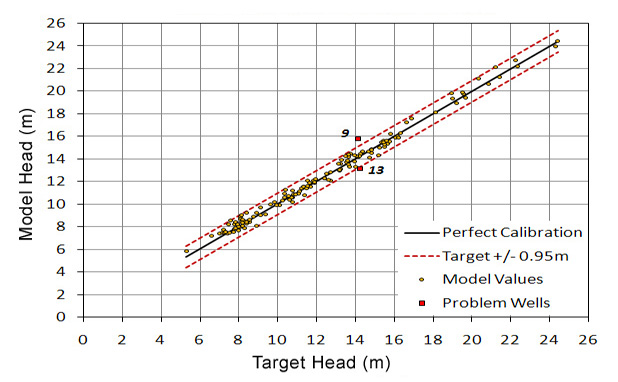
Calibration plots showing a match to within 1 m of target heads at 176 of 188 wells in region for the low water scenario (top) and 186 of 188 wells in the region for the high water scenario (bottom).
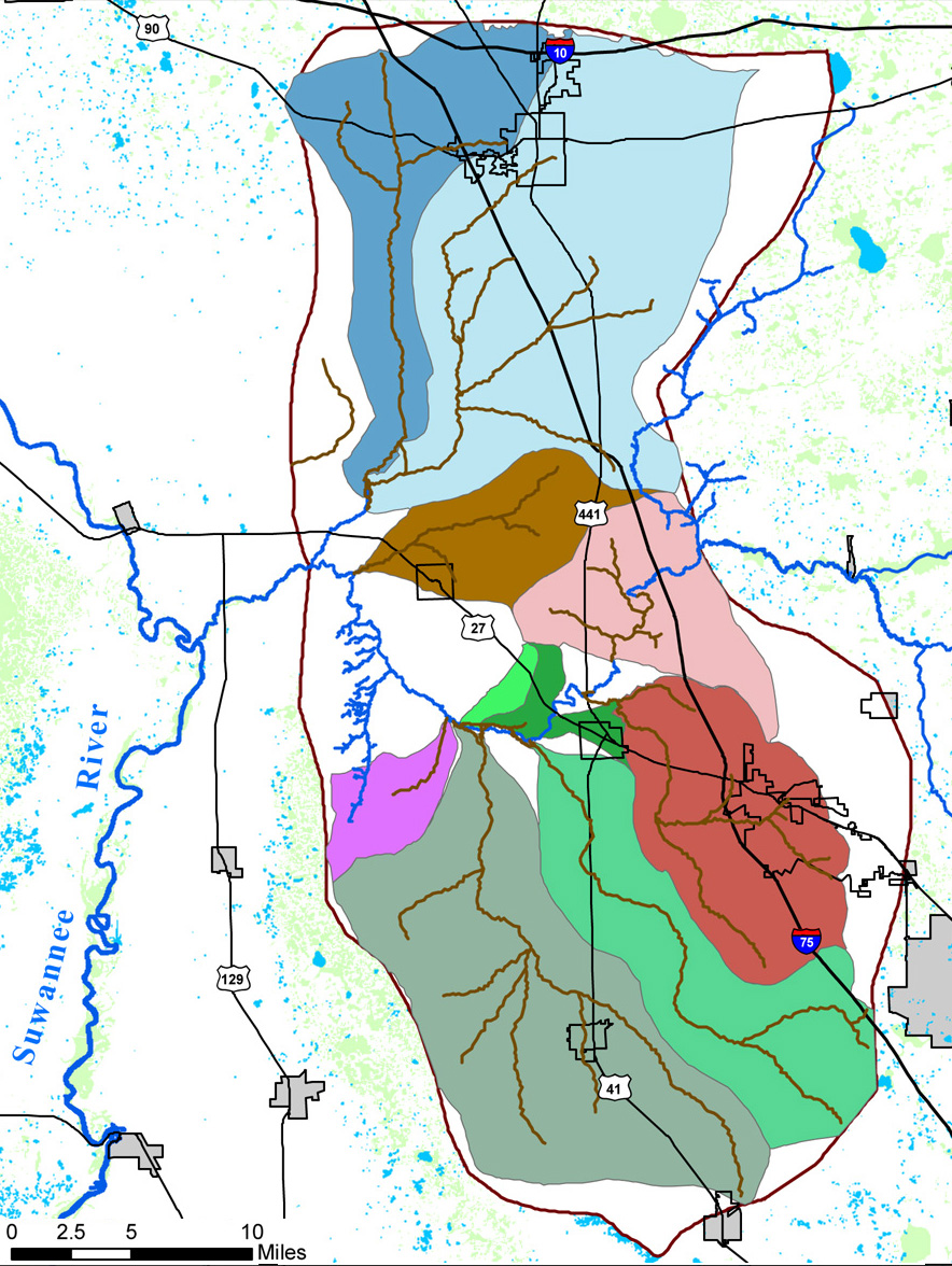
Model domain showing the delineation of individual springsheds from particle tracks exported from the low water scenario model run. This is the first numerical model to effectively delineate individual springsheds.
GeoHydros successfully developed a dual-permeability numerical model of groundwater flow through an extensively karstified basin that produced a vastly superior calibration to both groundwater heads and spring flows in the region than has been achieved by any of the existing porous media models. The model is the first of its kind to predict the location and size of karst conduits that cross the basin by locating the conduits in a manner that results in a best-fit to observed heads, spring flows, and groundwater velocities in the basin. The model was developed using existing data on time and on budget and has been released to the public via technical workshops presented to the Suwannee River and St. Johns River Water Management Districts as well as the Florida Department of Environmental Protection, and the USGS. The model was designed to be linked to adjacent models constructed for neighboring springsheds in the Suwannee River watershed.