Water Resource Management
| PROJECT NAME & LOCATION | DATE STARTED | DATE COMPLETED | |||||
| Yucca Mountain Project Las Vegas, NV |
May, 1998 | September, 1998 |
| ACTIVITY TITLE | APPROXIMATE CONTRACT VALUE | |||
| Geologic, 3-D Fault & Stratigraphic Modeling |
NA |
| CLIENT NAME & ADDRESS | TECHNICAL CONTACT | |||
| U.S. Department of Energy | Dr. Todd Kincaid |

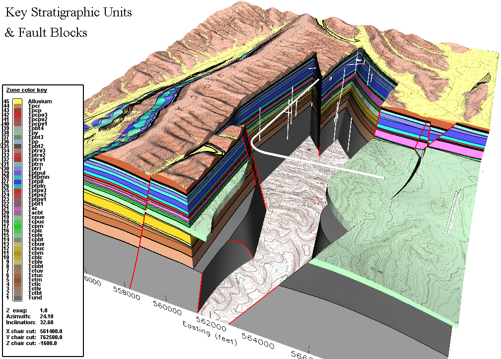
3D Perspective of the Alternative Geologic Framework Model of Yucca Mountain showing the faulted stratigraphy relative to a topographic map and the location of boreholes and the Exploratory Studies Facility

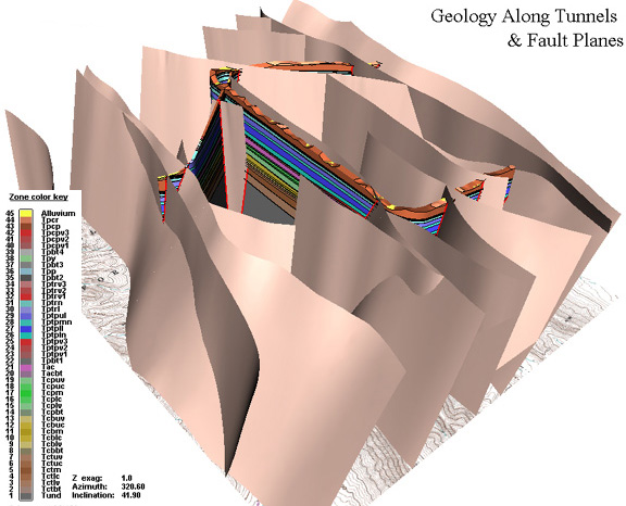
Rotated 3D perspective view of the AGFM showing the trend and dip of faults relative to the Exploratory Studies Facility.
His model incorporated an area of 31 square kilometers (12 square miles), a volume of 47 cubic kilometers
(11.4 cubic miles), and 42 stratigraphic units of variable thickness positioned across eighteen normal fault blocks. It was constructed from data provided by published geologic maps, 101 boreholes, information from tunnel data, and measured stratigraphic sections from outcrop areas.
His model was used by the Quality Assurance program to evaluate the reproducibility of geologic interpretations in the Integrated Site Model (ISM), which was designed to model existing site characterization data and provide facilities designers with a common framework for understanding site stratigraphy, rock properties, and mineralogy. The model was integrated with saturated and unsaturated zone flow and transport models, thermal studies, and Total System Performance Assessment studies. The ISM approach saved substantial time and money by effectively communicating subsurface data to the Nuclear Regulatory Commission thereby reducing the number of mandated tunnel and borehole installations.
Dr. Kincaid's work for the Yucca Mountain Project with geologic modeling and the integration of solids and process modeling to improve site characterization served as the inspiration for starting GeoHydros and implementing our Dual Modeling Approach.
